Ranong Province in Southern Thailand

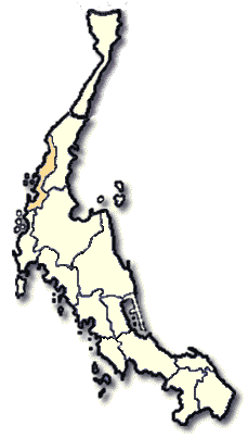
The first Southern province, bordering the Indian Ocean is Ranong, is located some 568 kms. from Bangkok. Ranong is very famous even though it is very small, occupying an area of only 3,298 square kilometers. This is because it is Thailand's rainiest province, and its narrowest. The Kra Isthmus, the narrowest part of the Malayan Peninsula is located here.
Ranong is a long narrow plot of land extending 169 kms. from north to south, and only 9 kms. at its narrowest. Most of the province is rain forested mountains. It borders on Chumphon to the north, Surat Thani and Phangnga to the south, Chumphon to the east and Myammar to the northwest. Ranong is administratively divided into four Amphoes and one King Amphoe; Amphoe Muang, Kra Buri, Kapoe, La-un and King Amphoe Suk Samran.
What to see and what to do in Ranong?
Hot Springs and Raksawarin Arboretum are near Wat Tapotharam , two kilometers east of Ranong township. The temperature of the water is about 65 degrees celcius. The deep shaded forest surrounding the hot spring is very lovely. It is an arboretum, named "Raksawarin", maintained by the Municipality and has rest pavilions and bathrooms.
Punyaban Waterfall
Another name of this waterfall is " Set Takuat Waterfall". It is located on Kra Buri - Ranong Road, 15 kms. before Ranong township area. The waterfall itself cascades from a high cliff and makes a refreshing rest stop for motorist touring along the south.
NgaoWaterfall is located 12 kms. south of Ranong township area where the stream cascades from a high mountain and can be seen from afar. The beautiful scenery of mountains and pastures is visible from the rest area near the fall. Ngao Waterfall is in Khlang Phrao National Park.
Hat Chan Damri is situated near km.8 on the Highway 4004 (Ranong-Pak Nam Route) from Ranong municipality with a 1 km. right turn along a hillside road. The small beach stretches near the mouth of Maenam Kra Buri. There various natural attractions, such as, Ko Song, Victoria Point and several other others. A marvellous scene at sunset can also be appreciated there.

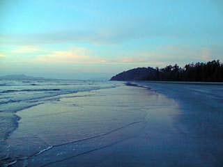
Ranong Beach
Chum Saeng Waterfall (or Sai Rung Waterfall) is located in Ban Pak Chan, Tambon Pak Chan, 80 kms. from the city or 16 kms. from Amphoe Kra Buri. It can be reached by traveling along.the Highway No.4 (the route to Chumphon) and then turning left at kms. 529-530 to the side road for another 3 kms. Sai Rung, which means a rainbow, was named because of the strong splashing which creates a rainbouw at the bottom of the fall.
Tham Phra Khayang is located at km. 564 on Highway No.4, 12 kms.from township area. An old legend links it to the establishment of Kra Buri town. Beautiful stalactite and stalagmite formations can be seen. It is said that there is Lek Lai ( a special iron element believed to be elastic and flexible like wax ) in this cave.
Laem Son National Park
From Ranong town along Phetchasem Road at km. 657, turn right another 10 kms. and findthe Laem Son National Park. With its area of over 315 square kilometers, the park includes beautiful beaches, islands and fascinating coral reef. Accommodations in the park are available in the form of bungalows and prior reservation is needed. Contact the National Park Division Tel. 579 - 0529, 579 - 4842.
Khlong Nakha Wild Life Sanctuary, is located about 25 kms. from the township area. Wild life of different types and species are scattered all around this evergreen tropical forest. This along with beautiful waterfalls make the sanctuary even more attractive for nature-loving tourists and visitors.
